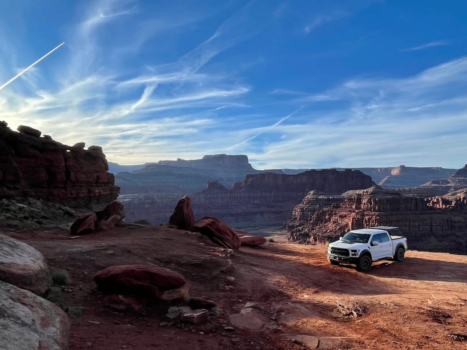

The Wider WABDR - Section 4A
While all sections of the WABDR are passable by just about any vehicle with moderate clearance and decent tires, this is probably my favorite go-to section and it’s one of the most scenic.
The Wider WABDR - Section 4A
Departure Time:
As early as you’re comfortable, allowing for at least 4 hours of trail time in the light.
Vehicle Checklist:
See our Off-Road Gear List!
A saw, chainsaw, and axe are very useful on this route in fall, winter, and spring as downed trees and encroaching brush are common and often easy to clear.
A Garmin InReach or other device for reaching out for help without cell service
Emergency gear for cold weather
A camera or drone is really handy on this scenic drive
DOWNLOAD THE GPS TRACKS AND KNOW HOW TO USE THEM ON YOUR GPS, ON-X, or GAIA!! - https://ridebdr.com/download-tracks/ - I cannot stress this enough. You CAN get lost on this trail!
A physical map as backup: Butler WABDR Map
Dan's Notes:
While all sections of the WABDR are passable by just about any vehicle with moderate clearance and decent tires, this is probably my favorite go-to section and it’s one of the most scenic. It’s a perfect drive for taking the family to play, and there are multiple opportunities to turn around if things get to tough or blocked. You should expect this route to take 2-4 hours in ideal conditions and about 4-6 hours in heavy snow. Your times may vary drastically depending on your skill level or how many times you stop to take pictures.
The Drive:
Coming over Highway 2 or I-90, I recommend dropping into 97 Rock House to start and end your day. They have good food, coffee, ice cream, and drinks with a great location for groups of friends and a friendly staff. It’s the perfect staging ground. Next, be sure to top off your fuel in Cashmere at the Chevron or Shell. If you’re coming from Leavenworth, the Safeway is typically a little cheaper.
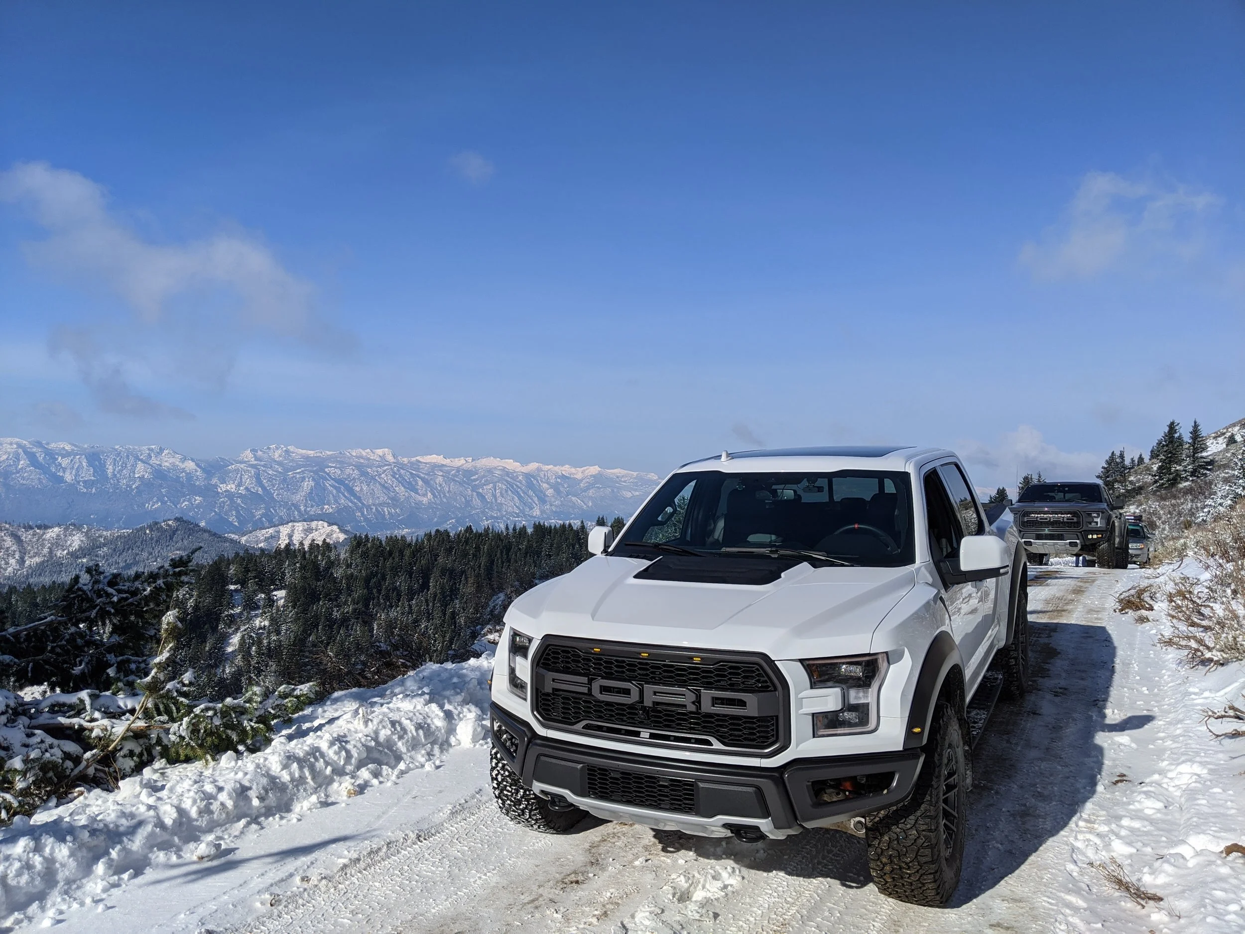
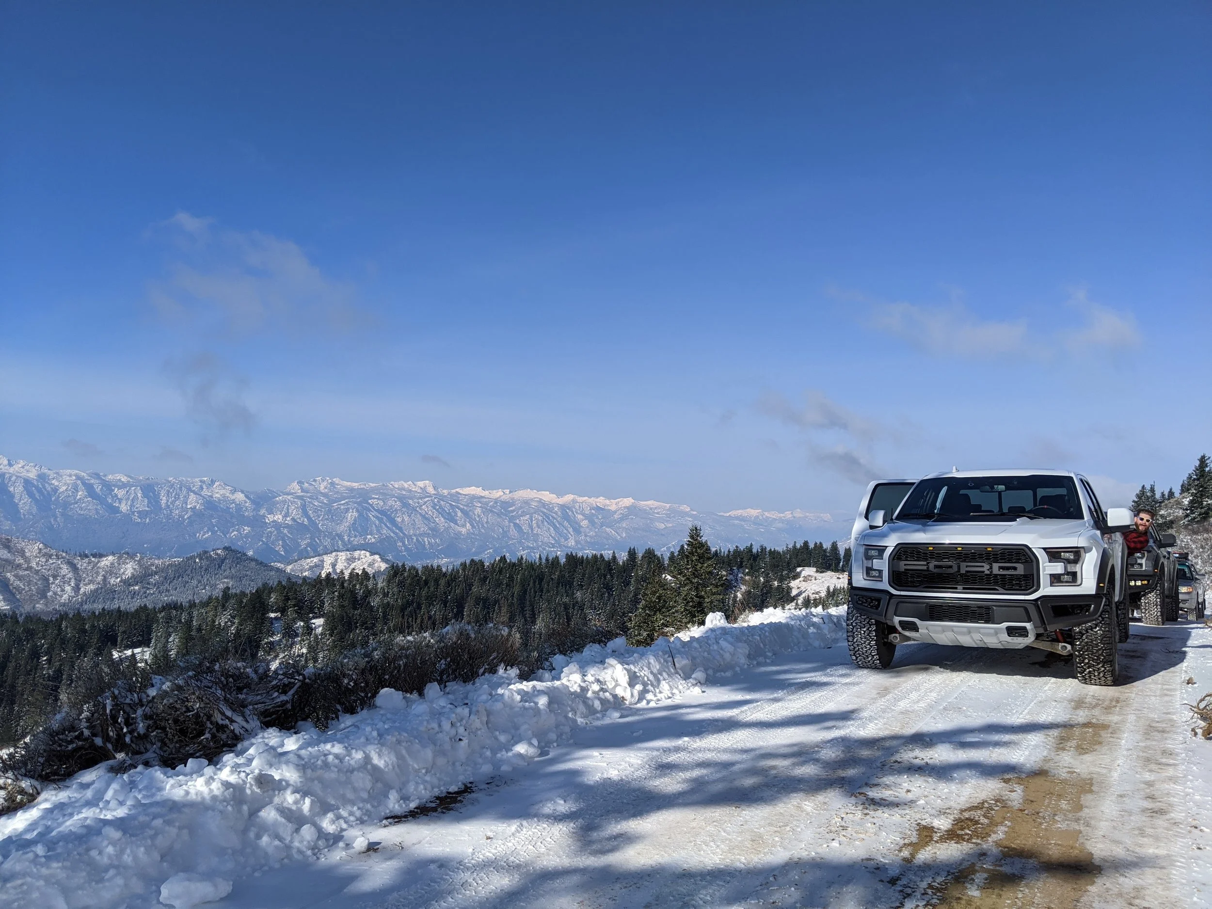
As you head up out of Cashmere the trail can be rutted, but look for bypasses as there are typically multiple ways around obstacles on this well traveled trail. I recommend airing down to 15-20 PSI mainly for comfort when the pavement ends, but in snowy conditions you should drop down even lower, to whatever you are comfortable with as a “low pressure”. In the Raptor and Land Cruiser, 12psi worked well at low speed for deep snow.
As you end the drive you can continue on to the rest of Section 4, but you should be aware it will take an extra 4-5 hours if you do, and you will probably get trail stripes in a larger vehicle. You won’t get body damage without being reckless, but keep in mind what I said about the trail stripes if you’re driving a wide vehicle like the Raptor. As I’ve put it on the map, you’ll snake down to Ardenvoir where there is a general store with limited hours in the off season, but they’ve got the basics (but no fuel). I’d head back to 97 Rock House for dinner and drinks to end the day.


The Backyard Overlander
This is my go-to local drive when I want to test something on the Land Cruiser or just go play in the snow with friends.

THE BACKYARD OVERLANDER
Departure Time: Earlier is better for photos, fresh snow, and less 4x4 traffic, but you can take this road any time of the day or night.
Car Checklist:
Tires in excellent condition
Decent suspension travel - potholes on this road and can destroy a stock height car. Don't say I didn't warn you.
Emergency gear for cold weather
An air compressor for airing up after airing down your tires for traction.
Dan's Notes:
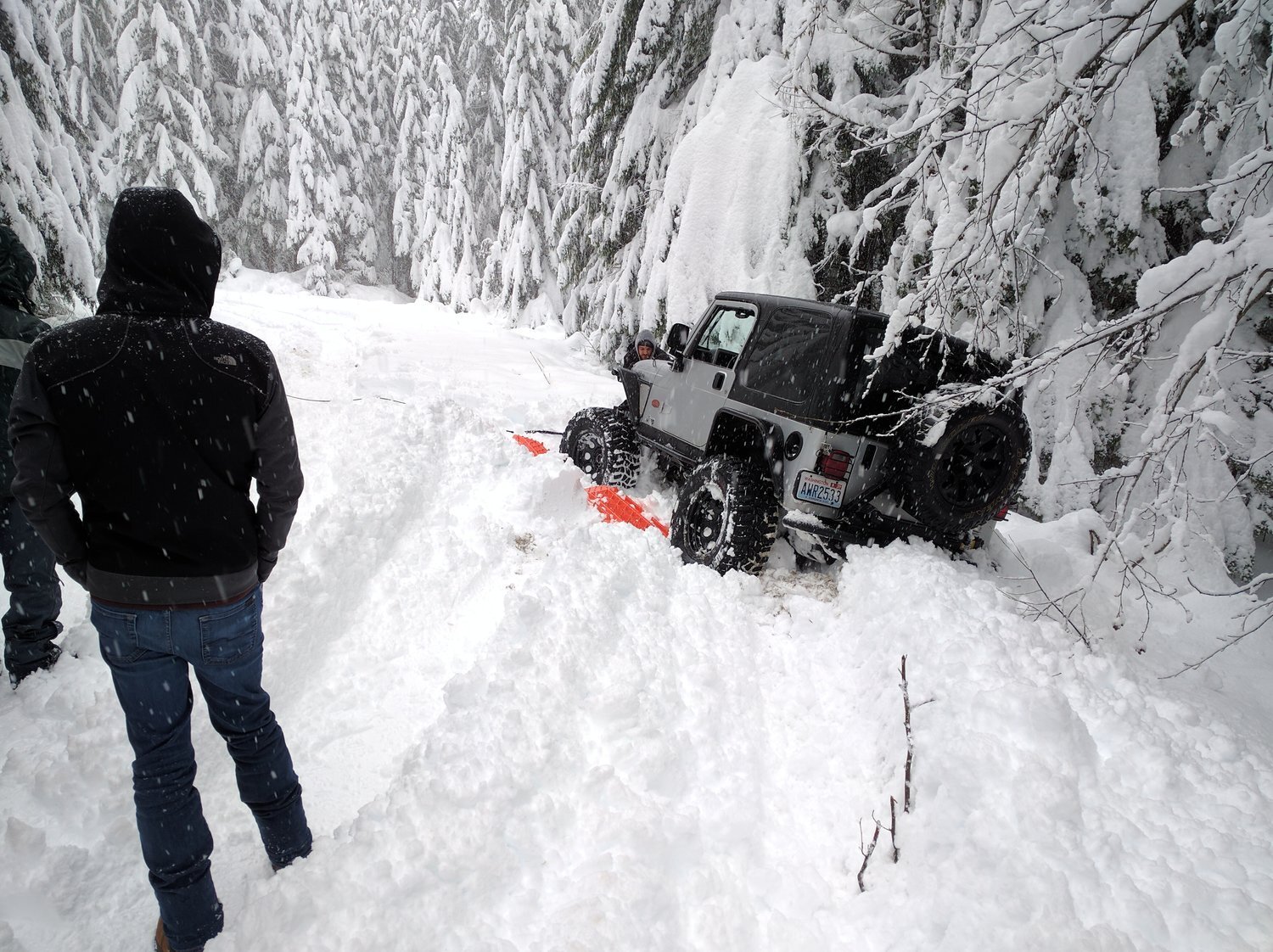
This is my go-to local drive when I want to test something on the Land Cruiser or just go play in the snow with friends. It's busy enough that you don't have to worry about getting in too much trouble and remote enough that you're not stuck in too much traffic. That said, don't skimp on the list above and if you get stuck you can expect to get very stuck most of the time. Ditches on both sides of the road and some narrow points will leave you searching for traction if you need to yield to oncoming traffic. It's also mandatory to air down low in deep snow like this or you will in fact get very stuck. Alright, onto the drive!
The Drive:
Head East on I-90 and take the time to stop and fill up in North Bend. There's a Safeway, Starbucks, McDonald's, etc all right off the exit so you'll have plenty of opportunity to get any supplies you'll need. NEVER head up into the mountains without a full tank of gas... and drinks.. and coffee.. and probably some jerky or something.
Get back on 90 until you reach exit 42, Tinkham Road. Use caution in the winter exiting here as it's a downhill offramp that's almost never plowed or de-iced and you get into quite the pucker factor moment if you're not ready. Ask me how I know!
Take a right at the bottom and you'll be on Tinkham. Just cross the small bridge to the parking lot and you'll have time to air down if needed. Keep going down until you reach NF-5510; it's not marked, but you'll likely still have cell service being close to I90 and it will show on your GPS... but let's discuss before you decide what to do now.
In the winter, NF-5510 is not plowed and I genuinely DO NOT recommend going up it unless you're with a group and someone in that group has a winch, not just a tow strap. Even if you do make it all the way up to the turn around at the top, the downhill section gets heavily packed by 4x4s and will turn to a solid sheet of ice. Go very, very, very slow when coming down the hill and don't panic when you start sliding forward. I actually drove down this section in reverse while going forward, using reverse as a brake. The only option to stop is to ditch it to the right going down, left will take you off an embankment.

So now that you know, you might want to just keep going, or if you're feeling brave take that right and get to the lower parking lot. It's a flat drive in to that, so momentum will be your friend in deep snow.
Once you've had your fill keep going and look for the fun little water crossing. It's nothing challenging, but how often do you get to drive across a flowing river with pavement under it so you know you won't get stuck? It makes for some fun photos and videos, so enjoy it!
As you exit Tinkham there is sometimes a built up snowbank used not to block the road, but just to keep less capable vehicles out. It also makes a great little jump or so I hear. Take a left off of Tinkham and get back on I90 and keep going East! You're just a few miles from Snoqualmie Pass, so may as well stop at Dru Bru for some lunch and good beer. Cheers!