
Meandering Up Middle Fork
Not every drive needs to test your limits. In fact, the really good ones you’ll enjoy regardless of the speed you drive them at.

Meandering Up Middle Fork
DEPARTURE TIME:
Sunrise or as early as possible to avoid traffic, but watch for animals and be patient.
CAR CHECKLIST:
A full tank of fuel before you depart
Optional: Washington Parks Discover Pass or $10 cash
DAN'S NOTES:
Not every great drive needs to be a test of bravery—or common sense. In fact, some of the best roads are the ones you'll enjoy no matter how fast you're driving.
Middle Fork Road is exactly that kind of drive.
Think of it as a miniature Yosemite experience tucked away in the Cascades. It's no secret among hikers, campers, and cyclists, but surprisingly, plenty of driving enthusiasts have never explored it. That's a shame, because it's one of the best group drives in Western Washington—as long as your group isn't full of people who think crossing the centerline is an acceptable driving technique.
This road is heavily used by hikers, cyclists (who are absolutely not moving over for you), campers, and just about every form of Pacific Northwest wildlife imaginable. Elk, deer, bear, and countless smaller critters all call this area home. It's not the place to go hunting apex speeds.
So why drive it?
The scenery.
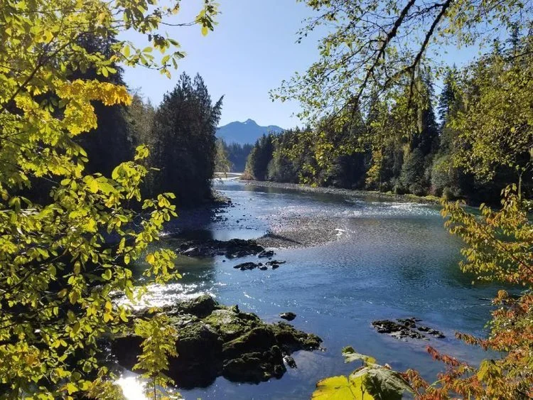
Middle Fork is all about photography stops, picnic spots, mountain views, and enjoying the journey. On a sunny day, it's hard to beat as a destination for a large group drive. If you're on a motorcycle, even better—you can enjoy more of the road while still respecting everyone else using it.
Start With Coffee
I highly recommend starting the day at Huxdotter Coffee.
Not only is the coffee excellent, but they serve what might genuinely be the best donuts in the Pacific Northwest. They source them from North Bend Bakery, so if Huxdotter happens to be sold out, head a few blocks over and grab them directly. Trust me on this one.
Especially the chocolate bars.
Road Conditions & Warnings
A few words of caution before you head out.
There are currently two washout sections along the route. They're short, but the potholes are serious enough to damage wheels, tires, or any low-hanging carbon fiber. They can be navigated without issue if you slow down and pay attention.
You'll also encounter two large drainage dips along the road. Low cars should approach these at an angle. A few stock 911s have completed the route without any problems, but they took their time and picked their lines carefully.
If you're worried about clearance, you can comfortably turn around before reaching these sections and still enjoy most of what makes this drive special. Just don't say I didn't warn you.
Garfield Ledges
The turnaround point for this route is near the trailhead for Garfield Ledges.
I do not recommend driving across the bridge beyond the parking area. The road on the far side is filled with large potholes that are difficult to avoid, even in vehicles with decent ground clearance.
Instead, park before the bridge and walk across.
The reward is a relatively short hike with fantastic views from Garfield Ledges. Bring a Discover Pass, and if the weather has been typical Pacific Northwest weather, bring a bag for your muddy shoes afterward.
It's also a fantastic trail run during the drier months of the year.
Post-Drive Food Stop
After the drive, head over to the very car-friendly Mt. Si Pub for lunch.
The restaurant is owned by racer David Wheaton, and it's become a favorite stop for enthusiasts finishing a morning drive through the area.
Grab a bite, relax, and if you stop in, tell them Dan's Drives sent you.
Route Map:

The Stress Reliever
This is my most popular drive to date. Far enough away but close enough to not take your whole day away.

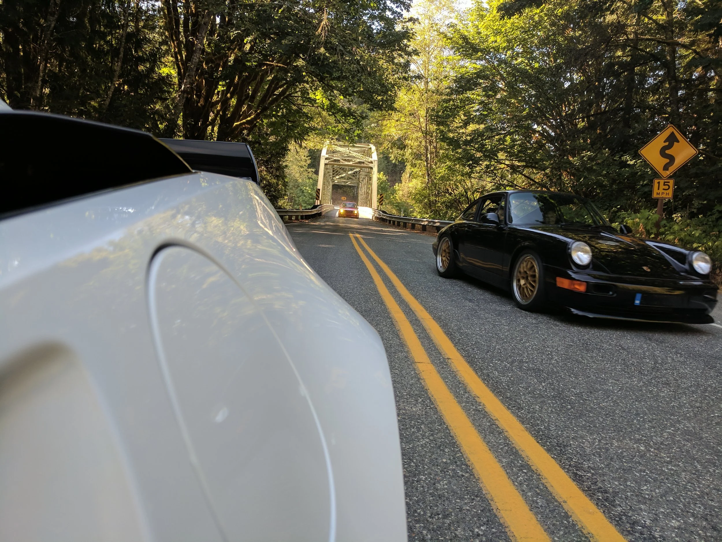
Dan’s C7 Z06, Jeff Miller’s 964 RS America, and John Zuberek’s E30 M3 on the bridge just outside of Concrete, WA.
MAP: THE STRESS RELIEVER
Departure Time
Like most great drives, earlier is better. The good news is that this route tends to stay relatively quiet even later in the day. Weekdays are often nearly empty, and weekends rarely feel crowded compared to the more famous driving roads around Washington.
Car Checklist
Before heading out, make sure you've got:
Good tires and brakes
Tire plug kit and air compressor
Radios if you're running with a group
Dan's Notes
Back in high school, I'd occasionally skip class and disappear onto these roads to clear my head. Every now and then, I still find myself doing the same thing. While Highway 9, 530, and Finn Settlement Road have picked up a little more traffic over the years, much of northern Snohomish County and western Skagit County still feels remarkably unchanged.
This is one of those drives that reminds you how much great road exists just outside the suburbs. About 100 miles long, easy to enjoy in almost any well-maintained car, and packed with enough variety to keep things interesting without ever becoming exhausting.
One thing to keep in mind: weather around Concrete and Darrington can be completely different from Arlington. Check conditions before you leave. You'll also lose cell service for a decent portion of the route, which honestly feels more like a feature than a bug these days.
The Drive
The best place to start is the Safeway Fuel Station in Arlington. Be aware there are two gas stations at the location: the Chevron sits up front near McDonald's, while the Safeway pumps are behind the store. Fill up here and you probably won't need fuel again for the remainder of the route.
Head north on Highway 9 and expect some light traffic until you pass through the tiny dot on the map known as Bryant. Once Bryant disappears in your mirrors, the drive starts getting interesting. Don't get too distracted though—the turn onto Finn Settlement Road isn't particularly well marked. After crossing the Pilchuck Creek Bridge, you're almost there.
Finn Settlement Road, which transitions into 44th Avenue and eventually Granstrom Road, is usually surprisingly empty. Logging operations can be active on some of the side roads, so keep an eye out for trucks. The route serves up a nice mix of sweepers, tighter corners, short straights, and mild elevation changes. There are plenty of opportunities to pass slower traffic safely, so be patient and avoid riding the bumper of the local who somehow manages to drive fifteen under the speed limit on every road in Washington.
Near the end of Granstrom Road, take a left at the "T" intersection onto Lake Cavanaugh Road. A right turn will loop you around Lake Cavanaugh instead. This stretch remains one of my favorite hidden roads in the area. There aren't many houses, there isn't much traffic, and the road flows well without requiring triple-digit speeds to enjoy yourself.
After reconnecting with Highway 9, take it easy through Big Lake. Don't be the reason the local sheriff has an easy day. Traffic can appear unexpectedly from the Walker Valley ORV area, and enforcement isn't uncommon. If you're hungry, the Big Lake Bar & Grill makes a solid lunch stop before continuing.
Just past Clear Lake, turn left onto South Skagit Highway.
The Forgotten Highway
South Skagit Highway feels like a road most people forgot exists.
When Highway 20 took over as the main route through the area, almost all traffic abandoned this road. The result is a beautiful stretch of pavement that often feels like it belongs exclusively to you. It winds along the Skagit River through forests, farmland, and some surprisingly scenic viewpoints while remaining in remarkably good condition for a road of its age.
Important Warning for Low Cars
If your car sits especially low, pay attention once you pass the Concrete-Sauk Valley Road cutoff.
The concrete road surface ahead hides a series of substantial dips that can catch you off guard. My stock-height Corvette Z06 and Nissan GT-R handled them without issue, but a friend in a very low E30 M3 spent part of the drive creeping through sections at around 15 mph to avoid scraping everything off the underside of the car.
If you're worried about clearance, don't feel obligated to continue through that section. Hop back onto Highway 20 using the cutoff road shown on the map. You'll still experience the majority of what makes this route enjoyable.
Concrete
Make a quick detour into Concrete for photos with the town's famous cement silos.
Movie buffs might recognize them from the 1993 film This Boy's Life, starring Robert De Niro and Leonardo DiCaprio. The giant "Welcome to Concrete" lettering painted on the towers has become one of the area's most recognizable landmarks and a favorite photo stop for enthusiasts passing through.
Sauk Valley and Darrington
After leaving Concrete, return to South Skagit Highway and continue east toward Sauk Valley Road.
One of the highlights of the route is the narrow one-lane steel bridge crossing the river. Traffic is usually minimal, making it a great place to stop, stretch your legs, and grab a few photos.
Eventually you'll reconnect with Highway 530 and descend into Darrington.
And yes, just like Big Lake:
Don't speed through Darrington.
The Mountain Loop Country Store makes an excellent stop for snacks, coffee, or a quick break before heading back toward Arlington.
If you've got extra time and want something completely unexpected to end the day, swing by the Outback Kangaroo Farm on your way home. Not many driving routes can end with kangaroos, but this one can.
Why I Keep Coming Back
There are faster roads in Washington. There are more technical roads. There are certainly more famous roads.
But few routes combine solitude, scenery, variety, and accessibility as well as this one.
It's the kind of drive that reminds you why we love driving in the first place—not because you're chasing lap times or trying to impress anyone, but because a good road, a good car, and a few quiet hours can still clear your head better than almost anything else.